Azores walking guides – Faial

For such a small and unassuming island, Faial holds a surprisingly significant place in the history of the Atlantic. In the 17th & 18th Centuries, the island was a crucial resupply point for Portuguese ships trading in Brazilian gold and spices from the Far East. In the 19th Century, the main harbour town of Horta became the wealthy H.Q. for telegraph companies connecting Europe and USA, evolving into a 20th Century communications hub for the D-Day landing beaches during the battle of Normandy in 1944.
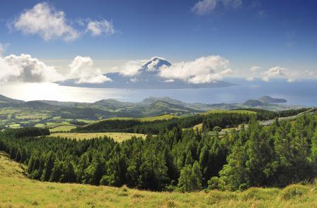
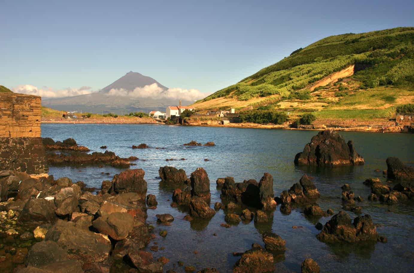
Nowadays, visitors are drawn to Faial by one of the Azores’ most arresting volcanic landscapes at Capelinhos, where a thirteen-month volcanic eruption in 1957 created 2km² of new land. Faial’s volcanic landscapes are easily explored via the island’s excellent walking trail network. From the grand Cabeco Gordo central caldera to the extinct Monte da Guia volcano, via the vineyards of Faja do Norte – there’s no better way of exploring Faial than on foot.
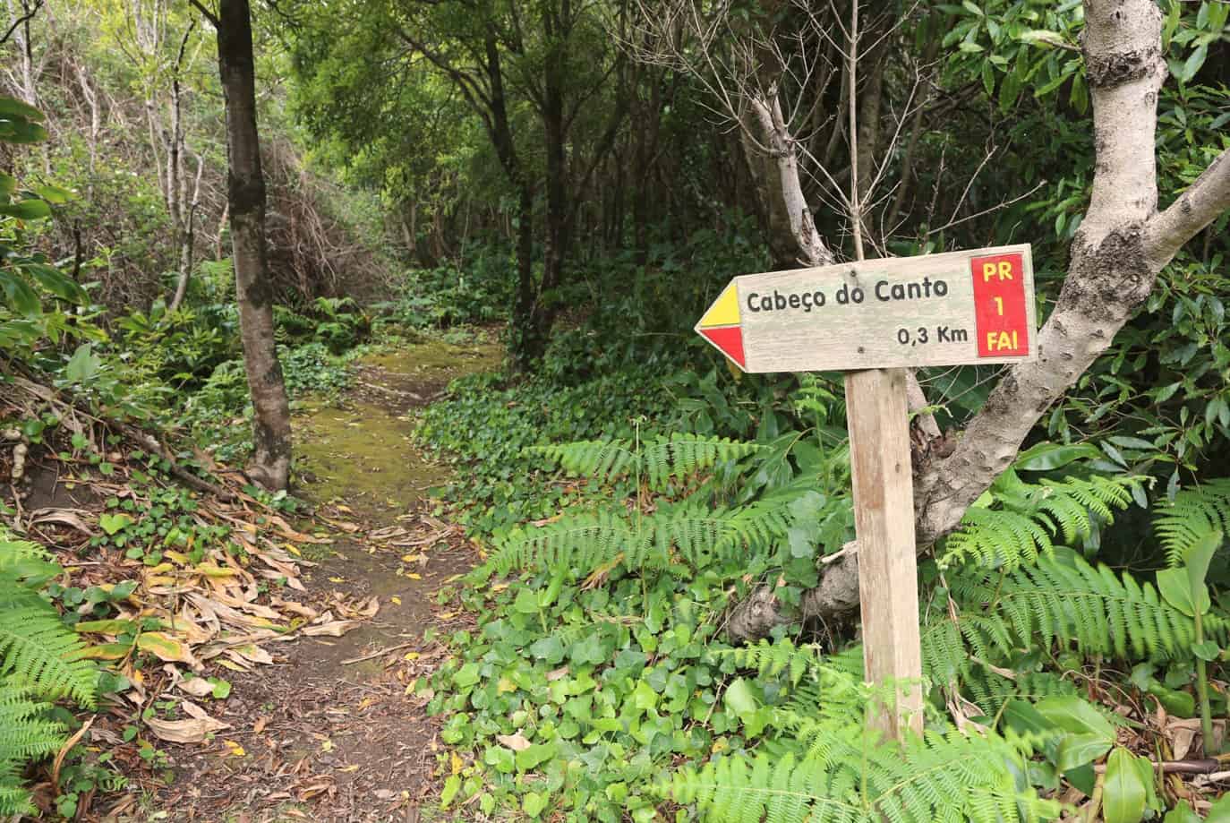
Cabeço do Canto – Faial PRC01 FAI
Circular // 2.6 km // Medium (for the uneven ground)
The Península do Cabeço has around 20 volcanic cones and this walk is an exploration of the volcanic cones of Cabeço Verde and Cabeço do Canto. There are great views towards the Capelinhos from Cabeço do Canto.
Footpath app route with live tracking
Download a printable Azores Trails guide
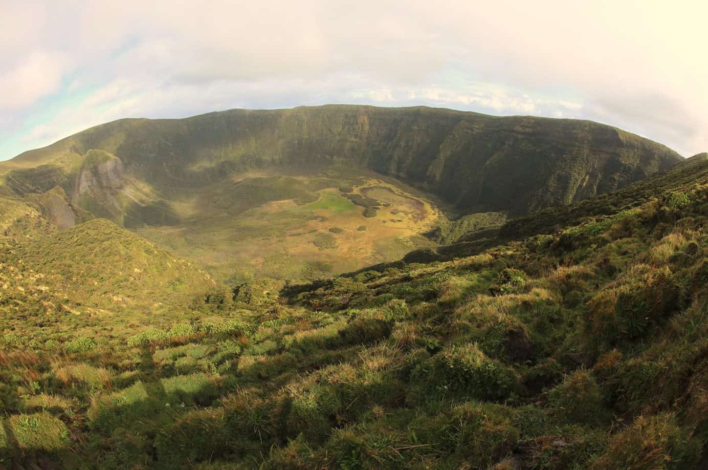
Caldeira – Faial PRC04 FAI
Circular // 6.8 km // Easy
Bang in the middle of the island, Faial’s central caldera dominates the landscape. The caldera rim is easily accessible via the mountain road that ends at the car park just below the rim, at nearly 1,000m. This circular route follows the rim for views into the green and 400m deep crater, and out to sea in all directions.
Footpath app route with live tracking
Download a printable Azores Trails guide
Caminhos Velhos – Faial PR07 FAI
Linear // 17.5 km // Hard
The Caminhos Velhos trail takes you all the way from sea level at the coast at Ribeirinha, to the top of the Caldera rim. It’s also easily walkable as a descent, starting with a transfer to the caldera and returning to the sea.
Footpath app route with live tracking
Download a printable Azores Trails guide
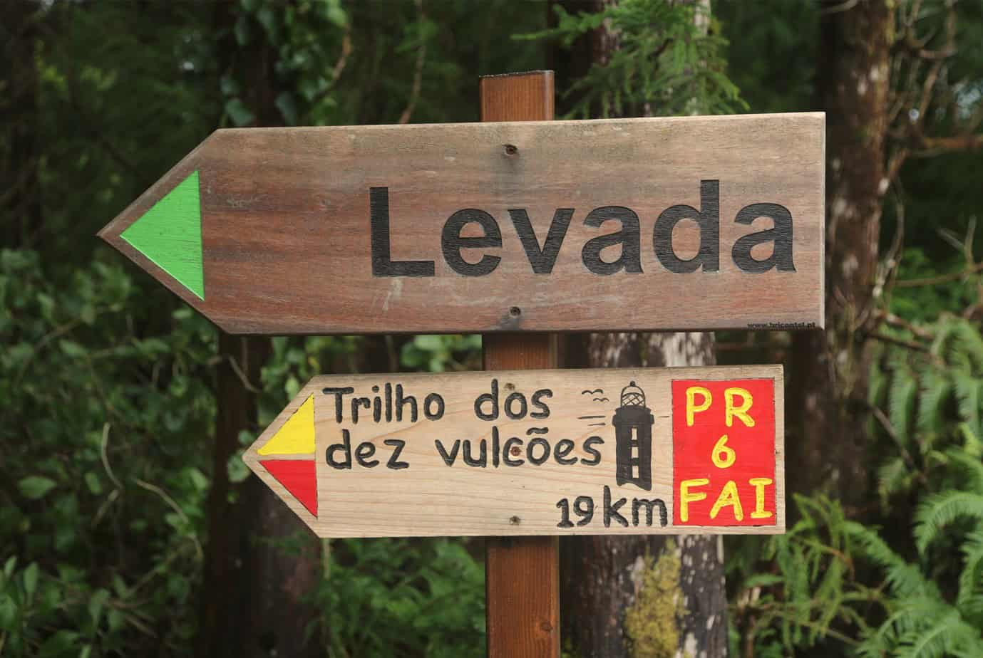
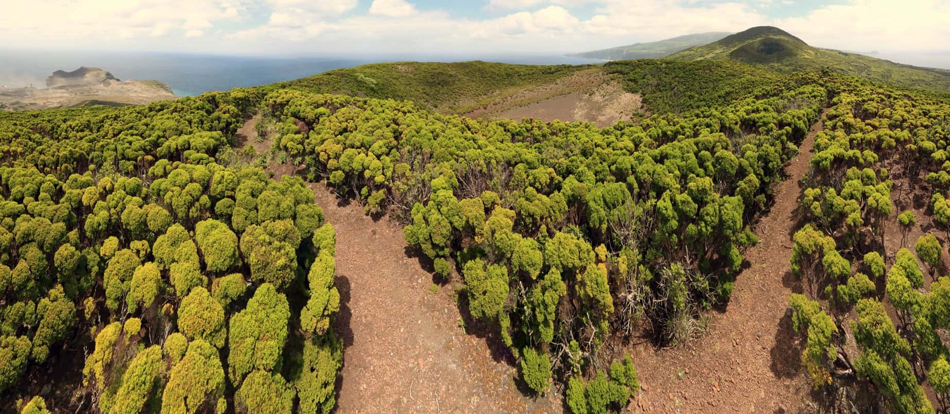
Dez Vulcões – Faial PR06 FAI
Linear // 19.3 km // Hard
The excellent-but-strenuous Ten Volcanoes walk starts at the Caldera rim, circling on the northern edge to reach a descending path on the west side. The trail then picks up a levada (water channel) skirting the volcano to the Cabeco dos Trinta cone. If you’re travelling with us then it’s possible to cut the walk short here – we can arrange our driver to pick you up and take you straight to the Capelinhos centre. If you’re continuing then the second half of the walk joins up several volcanic cones that lie in a line from Caldera to Capelinhos, which is where you’ll end up, some 20km from the start. We recommend taking this walk as a guided walk so that our personable local guides can talk with you about the volcanic landscape that you are travelling through, and bring it alive.
Footpath app route with live tracking
Download a printable Azores Trails guide
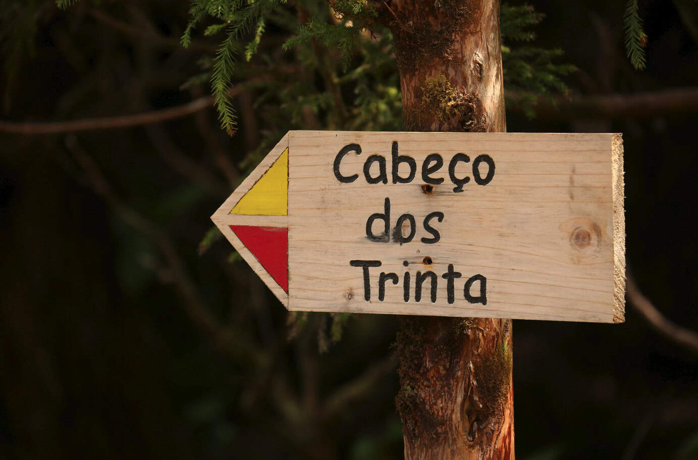
Archipelago Choice – Caldera to Cabeco dos Trinta
Linear // 7.8 km // Medium
One of the most popular self-guided walks taken by our clients, this variation of the Dez Vulcaoes trail takes you from the road end at the Caldera, south around the rim to cross Faial’s summit – Miradouro do Cabeco Gordo – and then picks up the same descent and levada as the Dez Vulcaoes route. The route finishes at the Cabeco dos Trinta where our driver will be waiting for you. Most then choose to drive to the Capelinhos eruption site of 1958 to see the new land created by the eruption, and to view the interesting visitor centre sited within the ash of the eruption.
Footpath app route with live tracking
Entre Montes – Faial PRC08 FAI
Circular // 3.4 km // Easy (steep up/down though)
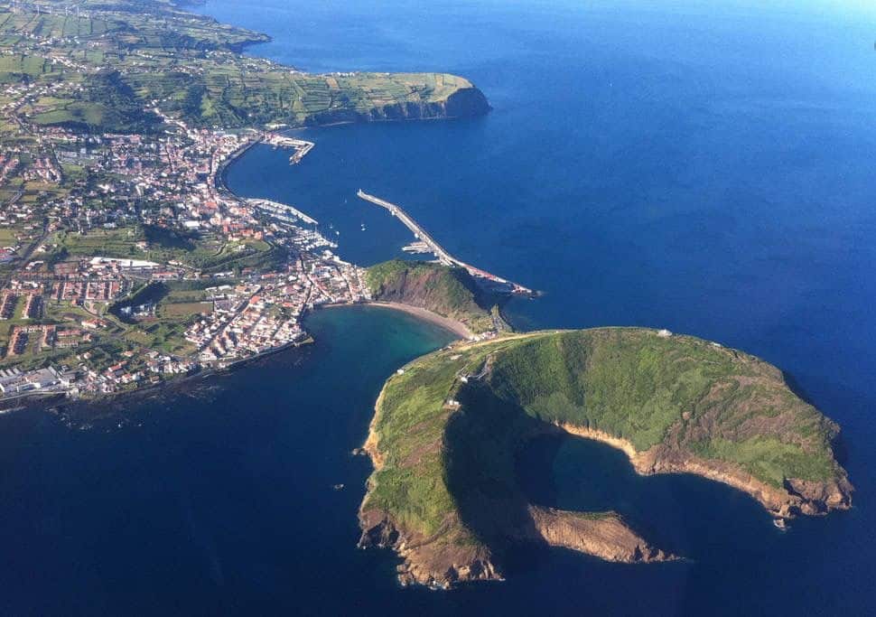
Monte da Guia guards the town of Horta and is the landform that’s also responsible for creating the bay of Porto Pim, and sheltering the area that’s now Faial’s harbour. This route climbs the mountain for views over Porto Pim Bay, towards Horta and over the centre of the island – and also over the hidden bay of the Reserva Natural das Caldeirinhas, formed by the collapsed volcanic cone. We’d join the route from Porto Pim, and would probably walk it in reverse – so anti-clockwise, walking first out to the Miradouro de Neptuno before ascending Monte da Guia. In this direction you’re then facing the bay and town as you return, before traversing the minor hill of Monte Queimadao and descending back to town. The Miradouro de Neptuno is so called after a famous photo taken during a storm, where a gigantic wave breaking over the viewpoint is said to resemble Neptune himself.
Footpath app route with live tracking
Download a printable Azores Trails guide
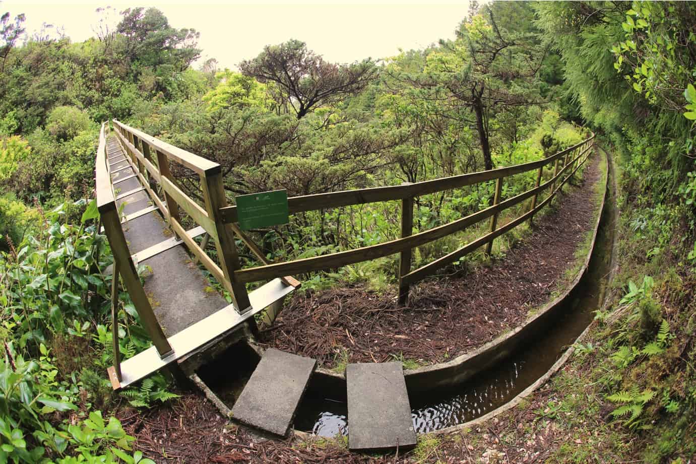
Levada – Faial PR03 FAI
Linear // 7.6 km // Easy
The levada that skirts the western slopes of the central caldera was constructed in 1964 in order to collect water for hydro electric power generation. As it’s reasonably flat, this walk is a great way to access the volcanic slopes without too much effort. Arrange to be transferred at either end before you set off.
Footpath app route with live tracking
Download a printable Azores Trails guide
Rocha da Fajã – Faial PRC02 FAI
Circular // 5 km // Medium
Fajã da Praia do Norte has a microclimate that’s ideal for Azorean vineyards and wine cellars. This route starts and finishes on the main circular road, descending to the rocky beach of Praia da Faja before re-ascending to the start point.
Footpath app route with live tracking
Download a printable Azores Trails guide
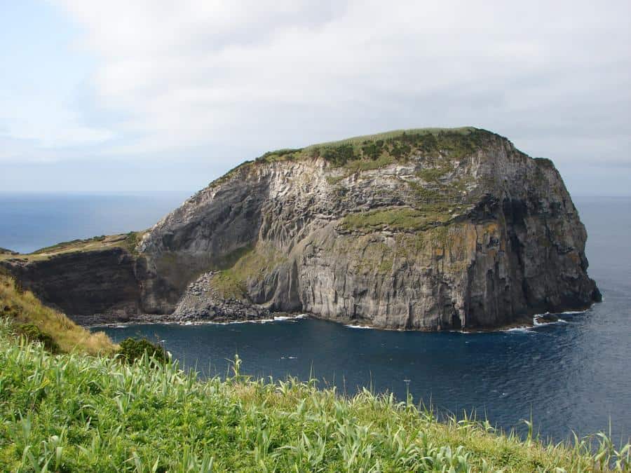
Rumo ao Morro de Castelo Branco – Faial PRC05 FAI
Circular // 3.7 km // Easy
The Castelo Branco is a coastal volcanic cone around 300,000 years old. This sort and easy route traverses sea cliffs, for excellent bird watching opportunities, to reach the Castelo Branco. Return is more direct via a tarmac road – or retrace your steps along the cliff top back to Lombega and your car.
Footpath app route with live tracking
Download a printable Azores Trails guide
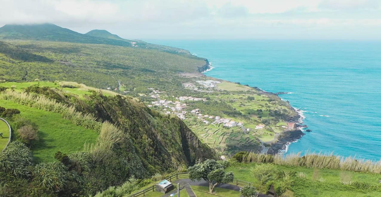
Ribeirinha – Faial PRC09 FAI
Circluar // 8.3 km // Easy
This easy circular route explores the Ribeirinha parish and landscape. The volcanic complex of Ribeirinha is the oldest part of Faial at around 800,000 years old. In context: the last UK volcanic activity was about 60 million years ago, and the youngest rocks in the British Isles are the Thames Valley and Southern Hampshire, who’s shallow water sedimentary sandstones and mudstones are from 2-3 million years ago.
Footpath app route with live tracking
Download a printable Azores Trails guide
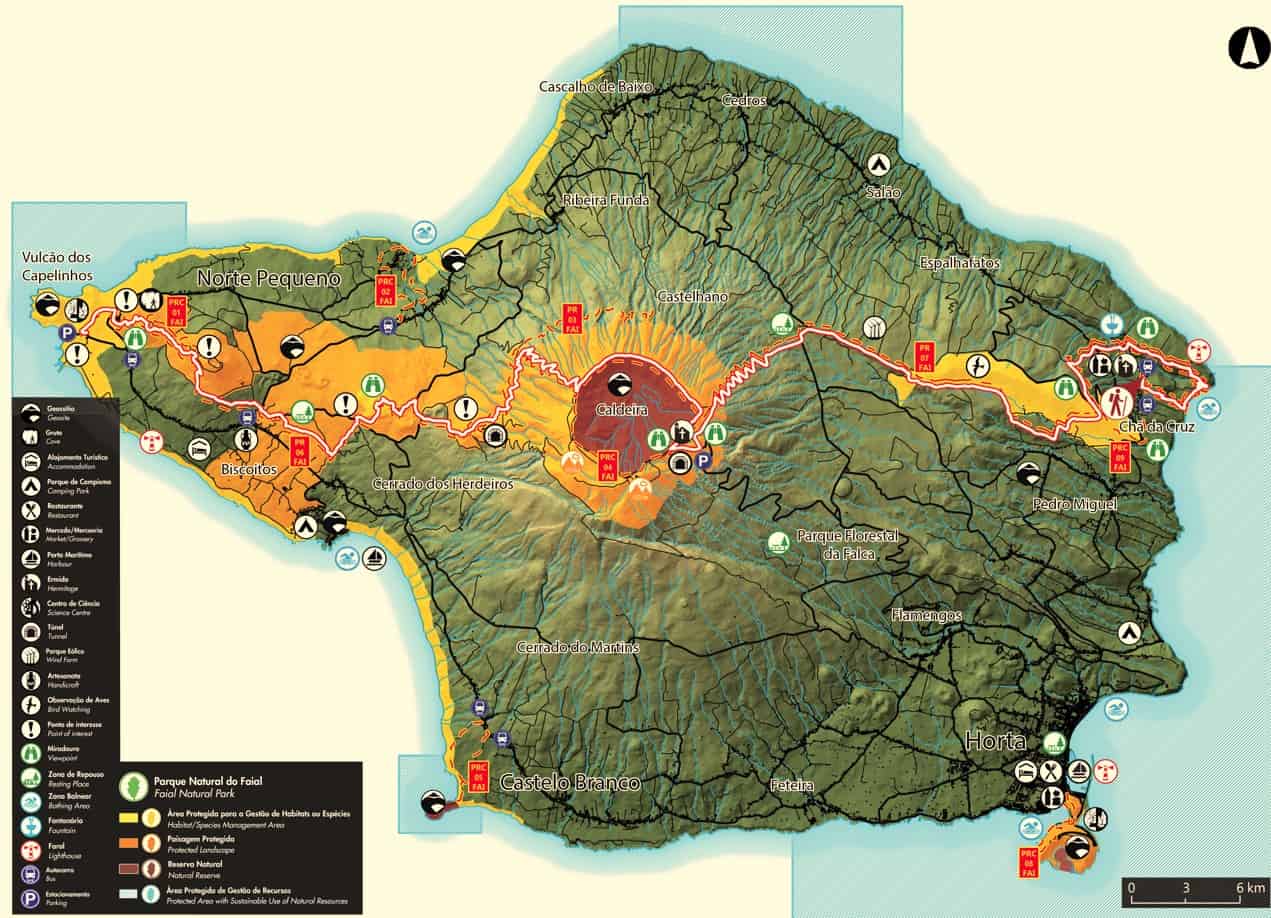
Faial from Coast to Coast
Linear // 36.8 km // Hard
A combination of the two routes Caminhos Velhos PR07 and Dez Vulcaoes PR06, the Faial Coast to Coast does exactly what it says on the tin, traversing the island from east to west. Along the walk you’ll circle the central caldera and finish at the Capelinhos eruption site of 1958. Most people chose to walk this route over two days with transfers in the middle back to accommodation in Horta. For the very fit and able the challenge is to complete it in a day …
Footpath app route with live tracking
Download a printable Azores Trails guide
Archipelago Choice – the Azores Specialists
We specialise in tailor-made holidays to the nine islands of the Azores. Our experienced team of specialists are ready to put together your personalised trip; just give them a call on 017687 721020.


Follow us online